


 关联应用
关联应用

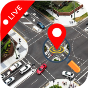
Live Satellite View & GPS Maps
High Definition Earth Imagery
开发者: Muhammad Asad Khan

26天15小时
最新版本上线距今
6
近1年版本更新次数
2024-12-23
全球最早版本上线日期
版本: 1.0.7
版本更新日期
2025-05-31
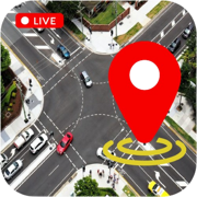
Live Satellite View & GPS Maps
High Definition Earth Imagery
更新日志
-bug fix应用描述
Satellite View is your ultimate tool for exploring the world from a whole new perspective! With high-resolution satellite imagery and real-time GPS tracking, this app lets you view any location on Earth from space. Whether you're planning a trip, exploring remote regions, or simply curious about the world around you, Satellite View offers seamless access to a wealth of geographical data, all at your fingertips.
Key Features:
* Real-Time Satellite Imagery: Access up-to-date satellite images of any location worldwide, allowing you to explore Earth with vivid, high-resolution details.
* Interactive Maps & Navigation: Seamlessly switch between satellite, terrain, and hybrid map views to navigate and explore locations with ease.
* GPS Tracking: Pinpoint your exact location with live GPS tracking, making it easy to plan routes and discover places nearby.
* Global Coverage: View satellite images from every corner of the planet, including urban areas, landscapes, oceans, and even remote regions.
* Zoom In/Out: Enjoy smooth zooming features, enabling you to get a closer look at both small and large geographical features.
* Satellite Layers & Customization: Toggle various layers, such as terrain, roads, borders, and more, for a personalized map experience.
* Historical Imagery: Explore past satellite imagery to see how specific areas have changed over time.
* User-Friendly Interface: Designed with simplicity in mind, the app’s intuitive interface makes it easy for users of all ages to navigate and explore.
* Offline Mode: Download specific regions for offline use, allowing you to access satellite imagery even when you’re not connected to the internet.
* Travel Planning: Get a bird's-eye view of destinations to plan your trips and understand the geography of your surroundings.
* Education & Learning: Ideal for students and researchers, the app provides an interactive platform for learning about the Earth’s geography, climate, and ecosystems.
* Outdoor Adventures: Use the satellite imagery to explore hiking trails, camping spots, and remote natural areas with real-world accuracy.
* Real Estate & Property Search: Explore property locations, assess landscapes, and analyze the proximity of amenities and infrastructure.
*
With Satellite View, you can explore Earth’s beauty, discover hidden locations, and view the planet as you've never seen before. Stay up-to-date with the latest satellite imagery and make informed decisions with real-time GPS data. Whether you’re a traveler, student, or outdoor enthusiast, Satellite View is your go-to app for exploring the world.版本: 1.0.6
版本更新日期
2025-05-25
Live Satellite View & GPS Maps
High Definition Earth Imagery
更新日志
-Google map loading issue fix应用描述
Satellite View is your ultimate tool for exploring the world from a whole new perspective! With high-resolution satellite imagery and real-time GPS tracking, this app lets you view any location on Earth from space. Whether you're planning a trip, exploring remote regions, or simply curious about the world around you, Satellite View offers seamless access to a wealth of geographical data, all at your fingertips.
Key Features:
* Real-Time Satellite Imagery: Access up-to-date satellite images of any location worldwide, allowing you to explore Earth with vivid, high-resolution details.
* Interactive Maps & Navigation: Seamlessly switch between satellite, terrain, and hybrid map views to navigate and explore locations with ease.
* GPS Tracking: Pinpoint your exact location with live GPS tracking, making it easy to plan routes and discover places nearby.
* Global Coverage: View satellite images from every corner of the planet, including urban areas, landscapes, oceans, and even remote regions.
* Zoom In/Out: Enjoy smooth zooming features, enabling you to get a closer look at both small and large geographical features.
* Satellite Layers & Customization: Toggle various layers, such as terrain, roads, borders, and more, for a personalized map experience.
* Historical Imagery: Explore past satellite imagery to see how specific areas have changed over time.
* User-Friendly Interface: Designed with simplicity in mind, the app’s intuitive interface makes it easy for users of all ages to navigate and explore.
* Offline Mode: Download specific regions for offline use, allowing you to access satellite imagery even when you’re not connected to the internet.
* Travel Planning: Get a bird's-eye view of destinations to plan your trips and understand the geography of your surroundings.
* Education & Learning: Ideal for students and researchers, the app provides an interactive platform for learning about the Earth’s geography, climate, and ecosystems.
* Outdoor Adventures: Use the satellite imagery to explore hiking trails, camping spots, and remote natural areas with real-world accuracy.
* Real Estate & Property Search: Explore property locations, assess landscapes, and analyze the proximity of amenities and infrastructure.
*
With Satellite View, you can explore Earth’s beauty, discover hidden locations, and view the planet as you've never seen before. Stay up-to-date with the latest satellite imagery and make informed decisions with real-time GPS data. Whether you’re a traveler, student, or outdoor enthusiast, Satellite View is your go-to app for exploring the world.版本: 1.0.4
版本更新日期
2025-03-24

Live Satellite View & GPS Maps
High Definition Earth Imagery
更新日志
-fix bug应用描述
Satellite View is your ultimate tool for exploring the world from a whole new perspective! With high-resolution satellite imagery and real-time GPS tracking, this app lets you view any location on Earth from space. Whether you're planning a trip, exploring remote regions, or simply curious about the world around you, Satellite View offers seamless access to a wealth of geographical data, all at your fingertips.
Key Features:
* Real-Time Satellite Imagery: Access up-to-date satellite images of any location worldwide, allowing you to explore Earth with vivid, high-resolution details.
* Interactive Maps & Navigation: Seamlessly switch between satellite, terrain, and hybrid map views to navigate and explore locations with ease.
* GPS Tracking: Pinpoint your exact location with live GPS tracking, making it easy to plan routes and discover places nearby.
* Global Coverage: View satellite images from every corner of the planet, including urban areas, landscapes, oceans, and even remote regions.
* Zoom In/Out: Enjoy smooth zooming features, enabling you to get a closer look at both small and large geographical features.
* Satellite Layers & Customization: Toggle various layers, such as terrain, roads, borders, and more, for a personalized map experience.
* Historical Imagery: Explore past satellite imagery to see how specific areas have changed over time.
* User-Friendly Interface: Designed with simplicity in mind, the app’s intuitive interface makes it easy for users of all ages to navigate and explore.
* Offline Mode: Download specific regions for offline use, allowing you to access satellite imagery even when you’re not connected to the internet.
* Travel Planning: Get a bird's-eye view of destinations to plan your trips and understand the geography of your surroundings.
* Education & Learning: Ideal for students and researchers, the app provides an interactive platform for learning about the Earth’s geography, climate, and ecosystems.
* Outdoor Adventures: Use the satellite imagery to explore hiking trails, camping spots, and remote natural areas with real-world accuracy.
* Real Estate & Property Search: Explore property locations, assess landscapes, and analyze the proximity of amenities and infrastructure.
*
With Satellite View, you can explore Earth’s beauty, discover hidden locations, and view the planet as you've never seen before. Stay up-to-date with the latest satellite imagery and make informed decisions with real-time GPS data. Whether you’re a traveler, student, or outdoor enthusiast, Satellite View is your go-to app for exploring the world.版本: 1.0.3
版本更新日期
2025-01-25

Live Satellite View & GPS Maps
High Definition Earth Imagery
更新日志
-Fix issues应用描述
Satellite View is your ultimate tool for exploring the world from a whole new perspective! With high-resolution satellite imagery and real-time GPS tracking, this app lets you view any location on Earth from space. Whether you're planning a trip, exploring remote regions, or simply curious about the world around you, Satellite View offers seamless access to a wealth of geographical data, all at your fingertips.
Key Features:
* Real-Time Satellite Imagery: Access up-to-date satellite images of any location worldwide, allowing you to explore Earth with vivid, high-resolution details.
* Interactive Maps & Navigation: Seamlessly switch between satellite, terrain, and hybrid map views to navigate and explore locations with ease.
* GPS Tracking: Pinpoint your exact location with live GPS tracking, making it easy to plan routes and discover places nearby.
* Global Coverage: View satellite images from every corner of the planet, including urban areas, landscapes, oceans, and even remote regions.
* Zoom In/Out: Enjoy smooth zooming features, enabling you to get a closer look at both small and large geographical features.
* Satellite Layers & Customization: Toggle various layers, such as terrain, roads, borders, and more, for a personalized map experience.
* Historical Imagery: Explore past satellite imagery to see how specific areas have changed over time.
* User-Friendly Interface: Designed with simplicity in mind, the app’s intuitive interface makes it easy for users of all ages to navigate and explore.
* Offline Mode: Download specific regions for offline use, allowing you to access satellite imagery even when you’re not connected to the internet.
* Travel Planning: Get a bird's-eye view of destinations to plan your trips and understand the geography of your surroundings.
* Education & Learning: Ideal for students and researchers, the app provides an interactive platform for learning about the Earth’s geography, climate, and ecosystems.
* Outdoor Adventures: Use the satellite imagery to explore hiking trails, camping spots, and remote natural areas with real-world accuracy.
* Real Estate & Property Search: Explore property locations, assess landscapes, and analyze the proximity of amenities and infrastructure.
*
With Satellite View, you can explore Earth’s beauty, discover hidden locations, and view the planet as you've never seen before. Stay up-to-date with the latest satellite imagery and make informed decisions with real-time GPS data. Whether you’re a traveler, student, or outdoor enthusiast, Satellite View is your go-to app for exploring the world.版本: 1.0.2
版本更新日期
2024-12-27
Live Satellite View & GPS Maps
High Definition Earth Imagery
更新日志
fixed issues.应用描述
Satellite View is your ultimate tool for exploring the world from a whole new perspective! With high-resolution satellite imagery and real-time GPS tracking, this app lets you view any location on Earth from space. Whether you're planning a trip, exploring remote regions, or simply curious about the world around you, Satellite View offers seamless access to a wealth of geographical data, all at your fingertips.
Key Features:
* Real-Time Satellite Imagery: Access up-to-date satellite images of any location worldwide, allowing you to explore Earth with vivid, high-resolution details.
* Interactive Maps & Navigation: Seamlessly switch between satellite, terrain, and hybrid map views to navigate and explore locations with ease.
* GPS Tracking: Pinpoint your exact location with live GPS tracking, making it easy to plan routes and discover places nearby.
* Global Coverage: View satellite images from every corner of the planet, including urban areas, landscapes, oceans, and even remote regions.
* Zoom In/Out: Enjoy smooth zooming features, enabling you to get a closer look at both small and large geographical features.
* Satellite Layers & Customization: Toggle various layers, such as terrain, roads, borders, and more, for a personalized map experience.
* Historical Imagery: Explore past satellite imagery to see how specific areas have changed over time.
* User-Friendly Interface: Designed with simplicity in mind, the app’s intuitive interface makes it easy for users of all ages to navigate and explore.
* Offline Mode: Download specific regions for offline use, allowing you to access satellite imagery even when you’re not connected to the internet.
* Travel Planning: Get a bird's-eye view of destinations to plan your trips and understand the geography of your surroundings.
* Education & Learning: Ideal for students and researchers, the app provides an interactive platform for learning about the Earth’s geography, climate, and ecosystems.
* Outdoor Adventures: Use the satellite imagery to explore hiking trails, camping spots, and remote natural areas with real-world accuracy.
* Real Estate & Property Search: Explore property locations, assess landscapes, and analyze the proximity of amenities and infrastructure.
*
With Satellite View, you can explore Earth’s beauty, discover hidden locations, and view the planet as you've never seen before. Stay up-to-date with the latest satellite imagery and make informed decisions with real-time GPS data. Whether you’re a traveler, student, or outdoor enthusiast, Satellite View is your go-to app for exploring the world.预订版本: 1.0.0
版本更新日期
2024-12-23
预订转上架日期
2024-12-23Live Satellite View & GPS Maps
High Definition Earth Imagery
更新日志
暂无更新日志数据
应用描述
暂无应用描述数据


微信公众号

七麦数据公众号

七麦研究院公众号
APP下载
- IOS
- Android

@2014-2022 qimai.cn,北京七麦科技股份有限公司 All Rights Reserved. 京ICP备14049953号
 京公网安备 11010502041000号


