


 关联应用
关联应用

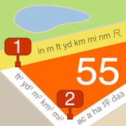
Planimeter 55. Measure on map.
Distance, perimeter and area.
开发者: Kalimex-Consulting s.r.o. @Blocoware & Stanislav Dvoychenko

33天22小时
最新版本上线距今
6
近1年版本更新次数
2018-08-03
全球最早版本上线日期
版本: 4.0
版本更新日期
2025-05-24
Planimeter 55. Measure on map.
Distance, perimeter and area.
更新日志
◆ Map collections:
Map collections let you prepare a map setup tailored to your mission.:
+ Choose a base map: Apple (street, satellite, hybrid), any online map source, or a downloaded/imported offline map.
+ Add map overlays (online map sources, downloaded/offline map) with adjustable transparency.
+ Add ground image overlays.
+ Switch between preconfigured map collections with a single tap.
◆ Ground Image Overlays:
+ Import KMZ ground image overlays directly from the map list screen.
+ Improved performance when displaying large ground image overlays in the maps list by using pre-cached thumbnail previews.应用描述
Measure distance, perimeter, and area on a map with ease. Add stand-alone points to mark locations and understand exactly what’s where. Capture photos with location, direction, altitude, and timestamp data. Share and export your projects seamlessly. Planimeter 55 is the ideal tool for measuring construction sites, roofs, lawns, fences, paving, pools, parking lots, fields, and paths. Or simply for placing stand-alone points on a map for better spatial understanding.
Why choose Planimeter 55?
• Precise control of your planned or measured areas. As you move the map, the app instantly displays the calculated area or distance, including the lengths of adjacent lines—even before you add a new point.
• Native Google Maps support for enhanced zoom. Zoom in closer on satellite and hybrid maps for high-detail measurements.
• Detailed point management. Assign individual colors to points and attach text notes, audio recordings, or images for comprehensive data collection.
• Easy point editing. Move points directly on the main map screen (tap a point and select Move) or in the dedicated point editor. Before confirming, you’ll see the updated area, perimeter, and distance calculations in real time.
• Organize your data. Show or hide shapes and point collections to focus on what’s important for your current project.
• Flexible measurement units. Customize when distances display in feet or meters versus miles or kilometers. The same flexibility applies to area units.
• Custom URL maps, offline maps, and map imports. Planimeter 55 includes Apple Maps and Google Maps by default. You can also add custom URL maps, download offline maps, or import your own maps (mbtiles, sqlitedb) created on your PC or Mac.
• KMZ export and import. Transfer shapes and point collections, including images and audio notes, to continue your work across multiple devices.
• Built-in camera tool. Attach geo-referenced photos to your points for a complete survey experience.
What’s included in the Basic Version:
• Create an unlimited number of points and temporary measurement shapes (areas or routes).
• To measure a new shape, simply discard the previous one and start again.
Unlock the Pro Pack Upgrade for even more:
• Full support for Google Maps, custom URL maps, offline maps, and imported maps (with enhanced zoom for satellite and hybrid maps).
• Save and manage multiple point collections and shapes.
• Import and export individual points or entire shapes and collections.
• Save and share map snapshots showing only the objects you’ve created—without UI buttons or tools.
Support and Help
Access Documentation or Support and Feedback via the MENU (hamburger icon) within the app. For direct support, email stan@blocoware.com. We respond to all emails within a few hours, or up to 9 hours if they arrive during CET/EU night hours.
Wishing you happy measuring!
The Planimeter 55 Team
Terms of Use: https://www.apple.com/legal/internet-services/itunes/dev/stdeula/版本: 3.9
版本更新日期
2025-04-03

Planimeter 55. Measure on map.
Distance, perimeter and area.
更新日志
◆ Import:
+ Points and photos can now be imported from files directly within the app. Supported formats: KMZ, KML, GPX, CSV, and TXT. Use the ‘More’ button on the Points screen.
Don’t miss the major updates from the previous version:
+ Open/Import Offline Maps from Disk/Files Directly in the App. To open or import a map directly in the app, use the '+' button on the map settings (list) screen and select the new option: Import offline map
+ Export/Share Offline Maps. To share or export a map, tap the 'Action' button on the offline map details screen.应用描述
Measure distance, perimeter and area on a map. Add stand alone points to understand better what is where on a map. Capture photos stamped with location, direction, altitude and time. Share and export your projects.
Planimeter app will be useful for measuring construction sites, roofs, lawns, fences, paving, pools, parking lots, fields and paths. Or even for just putting stand alone points on a map.
Where this planimeter app stands out?
- Precise control of the planned/measured area. As you move a map, the app will show you what area/distance is going to be and what would be the size of adjacent lines. Even before you add a new point.
- Native Google maps support adds extra zoom-in ability for satellite and hybrid maps.
- Every point can have its own color and have text, audio and image attached.
- You can move point directly on a main map screen (tap on a point and pick Move option) or in the dedicated point editor screen. Again, before you confirm the move you know perfectly what the resulting area/perimeter/distance will be.
- You can hide/show shapes and point collections. This way you can focus only on what is important for the current project.
- Flexible units of measurement allow you to configure when display of feet or meters changes to miles and kilometers. Same for area units.
- Custom url, offline and import maps. Apple maps and Google maps are built into the app. And then, you can add other maps. The app supports adding custom url maps, downloading offline maps or importing maps (mbtiles, sqlitedb) that you might have crafted on your PC or Mac.
- Kmz export and import option allows to transfer shapes and point collections in their entirety, including images and audio notes. This allows you to continue working on your project on different devices.
Basic version allows you to create unlimited number of points and temporary measurement shapes (areas or routes), so you can measure with no limits. To add a new shape to measure, you just discard the previous one.
Pro pack upgrade adds:
- Google and custom url, offline, imported maps support. Google maps adds extra zoom ability for satellite and hybrid maps.
- Ability to save multiple point collections/shapes.
- Import and export for a single point and whole shapes/collections.
- Saving and sharing a map snapshot, the one that shows only the objects that you created on a map - buttons and tools removed.
Pro Pack upgrade is a one off upgrade, no subscription or recurring charges are involved.
Use MENU (hamburger) button > DOCUMENTATION or SUPPORT AND FEEDBACK options to get help. Just in case, support email is stan@blocoware.com. All emails are answered within hours or up to 9 hours if they come during CET/EU night time.
Wishing your happy measuring!
Planimeter 55 team.版本: 3.8
版本更新日期
2025-03-17

Planimeter 55. Measure on map.
Distance, perimeter and area.
更新日志
◆ Offline maps:
+ Open/Import Offline Maps from Disk/Files Directly in the App. To open or import a map directly in the app, use the '+' button on the map settings (list) screen and select the new option: Import offline map
+ Export/Share Offline Maps. To share or export a map, tap the 'Action' button on the offline map details screen.应用描述
Measure distance, perimeter and area on a map. Add stand alone points to understand better what is where on a map. Capture photos stamped with location, direction, altitude and time. Share and export your projects.
Planimeter app will be useful for measuring construction sites, roofs, lawns, fences, paving, pools, parking lots, fields and paths. Or even for just putting stand alone points on a map.
Where this planimeter app stands out?
- Precise control of the planned/measured area. As you move a map, the app will show you what area/distance is going to be and what would be the size of adjacent lines. Even before you add a new point.
- Native Google maps support adds extra zoom-in ability for satellite and hybrid maps.
- Every point can have its own color and have text, audio and image attached.
- You can move point directly on a main map screen (tap on a point and pick Move option) or in the dedicated point editor screen. Again, before you confirm the move you know perfectly what the resulting area/perimeter/distance will be.
- You can hide/show shapes and point collections. This way you can focus only on what is important for the current project.
- Flexible units of measurement allow you to configure when display of feet or meters changes to miles and kilometers. Same for area units.
- Custom url, offline and import maps. Apple maps and Google maps are built into the app. And then, you can add other maps. The app supports adding custom url maps, downloading offline maps or importing maps (mbtiles, sqlitedb) that you might have crafted on your PC or Mac.
- Kmz export and import option allows to transfer shapes and point collections in their entirety, including images and audio notes. This allows you to continue working on your project on different devices.
Basic version allows you to create unlimited number of points and temporary measurement shapes (areas or routes), so you can measure with no limits. To add a new shape to measure, you just discard the previous one.
Pro pack upgrade adds:
- Google and custom url, offline, imported maps support. Google maps adds extra zoom ability for satellite and hybrid maps.
- Ability to save multiple point collections/shapes.
- Import and export for a single point and whole shapes/collections.
- Saving and sharing a map snapshot, the one that shows only the objects that you created on a map - buttons and tools removed.
Pro Pack upgrade is a one off upgrade, no subscription or recurring charges are involved.
Use MENU (hamburger) button > DOCUMENTATION or SUPPORT AND FEEDBACK options to get help. Just in case, support email is stan@blocoware.com. All emails are answered within hours or up to 9 hours if they come during CET/EU night time.
Wishing your happy measuring!
Planimeter 55 team.版本: 3.7.2
版本更新日期
2025-01-15

Planimeter 55. Measure on map.
Distance, perimeter and area.
更新日志
◆ Updated the World Magnetic Model for 2025–2029 to ensure accurate declination data between true north and magnetic north.
◆ Fixed the issue with imported offline map files not being deleted when you delete the map in the app:
Option added to MENU > Settings > ... > Maintenance > Find and delete orphaned offline maps. Turns out that imported offline map files (.sqlitedb or .mbtiles) were not deleted when you delete the map in the app. Thus large files might have stayed in the app. If you have ever imported and deleted the offline maps, please check if some of the files are not left over.应用描述
Measure distance, perimeter and area on a map. Add stand alone points to understand better what is where on a map. Capture photos stamped with location, direction, altitude and time. Share and export your projects.
Planimeter app will be useful for measuring construction sites, roofs, lawns, fences, paving, pools, parking lots, fields and paths. Or even for just putting stand alone points on a map.
Where this planimeter app stands out?
- Precise control of the planned/measured area. As you move a map, the app will show you what area/distance is going to be and what would be the size of adjacent lines. Even before you add a new point.
- Native Google maps support adds extra zoom-in ability for satellite and hybrid maps.
- Every point can have its own color and have text, audio and image attached.
- You can move point directly on a main map screen (tap on a point and pick Move option) or in the dedicated point editor screen. Again, before you confirm the move you know perfectly what the resulting area/perimeter/distance will be.
- You can hide/show shapes and point collections. This way you can focus only on what is important for the current project.
- Flexible units of measurement allow you to configure when display of feet or meters changes to miles and kilometers. Same for area units.
- Custom url, offline and import maps. Apple maps and Google maps are built into the app. And then, you can add other maps. The app supports adding custom url maps, downloading offline maps or importing maps (mbtiles, sqlitedb) that you might have crafted on your PC or Mac.
- Kmz export and import option allows to transfer shapes and point collections in their entirety, including images and audio notes. This allows you to continue working on your project on different devices.
Basic version allows you to create unlimited number of points and temporary measurement shapes (areas or routes), so you can measure with no limits. To add a new shape to measure, you just discard the previous one.
Pro pack upgrade adds:
- Google and custom url, offline, imported maps support. Google maps adds extra zoom ability for satellite and hybrid maps.
- Ability to save multiple point collections/shapes.
- Import and export for a single point and whole shapes/collections.
- Saving and sharing a map snapshot, the one that shows only the objects that you created on a map - buttons and tools removed.
Pro Pack upgrade is a one off upgrade, no subscription or recurring charges are involved.
Use MENU (hamburger) button > DOCUMENTATION or SUPPORT AND FEEDBACK options to get help. Just in case, support email is stan@blocoware.com. All emails are answered within hours or up to 9 hours if they come during CET/EU night time.
Wishing your happy measuring!
Planimeter 55 team.版本: 3.7.1
版本更新日期
2024-12-20

Planimeter 55. Measure on map.
Distance, perimeter and area.
更新日志
◆ More updates for iOS 18:
• The search text for points, places, and addresses is now properly displayed in black on iOS 18 devices.
• Fixed an issue where the new coordinates converter was not displayed in the point editor. This issue was not related to iOS 18 but was caused by the new development tools, affecting all devices from iOS 15 to 18.应用描述
Measure distance, perimeter and area on a map. Add stand alone points to understand better what is where on a map. Capture photos stamped with location, direction, altitude and time. Share and export your projects.
Planimeter app will be useful for measuring construction sites, roofs, lawns, fences, paving, pools, parking lots, fields and paths. Or even for just putting stand alone points on a map.
Where this planimeter app stands out?
- Precise control of the planned/measured area. As you move a map, the app will show you what area/distance is going to be and what would be the size of adjacent lines. Even before you add a new point.
- Native Google maps support adds extra zoom-in ability for satellite and hybrid maps.
- Every point can have its own color and have text, audio and image attached.
- You can move point directly on a main map screen (tap on a point and pick Move option) or in the dedicated point editor screen. Again, before you confirm the move you know perfectly what the resulting area/perimeter/distance will be.
- You can hide/show shapes and point collections. This way you can focus only on what is important for the current project.
- Flexible units of measurement allow you to configure when display of feet or meters changes to miles and kilometers. Same for area units.
- Custom url, offline and import maps. Apple maps and Google maps are built into the app. And then, you can add other maps. The app supports adding custom url maps, downloading offline maps or importing maps (mbtiles, sqlitedb) that you might have crafted on your PC or Mac.
- Kmz export and import option allows to transfer shapes and point collections in their entirety, including images and audio notes. This allows you to continue working on your project on different devices.
Basic version allows you to create unlimited number of points and temporary measurement shapes (areas or routes), so you can measure with no limits. To add a new shape to measure, you just discard the previous one.
Pro pack upgrade adds:
- Google and custom url, offline, imported maps support. Google maps adds extra zoom ability for satellite and hybrid maps.
- Ability to save multiple point collections/shapes.
- Import and export for a single point and whole shapes/collections.
- Saving and sharing a map snapshot, the one that shows only the objects that you created on a map - buttons and tools removed.
Pro Pack upgrade is a one off upgrade, no subscription or recurring charges are involved.
Use MENU (hamburger) button > DOCUMENTATION or SUPPORT AND FEEDBACK options to get help. Just in case, support email is stan@blocoware.com. All emails are answered within hours or up to 9 hours if they come during CET/EU night time.
Wishing your happy measuring!
Planimeter 55 team.版本: 3.7
版本更新日期
2024-09-20

Planimeter 55. Measure on map.
Distance, perimeter and area.
更新日志
◆ Optimizations for iOS 18. Supported versions of iOS are now 15-18.
◆ Added a new text input-based coordinates converter. You'll find it in several places:
- MENU > Coordinates converter.
- In the point editor, to the left of the Done button or in the Latitude/Longitude, UTM, MGRS rows.
- On the map, in the map search > Coordinates.
• The new coordinates converter also supports the OSGB and SK 42 coordinate systems, in addition to the current Latitude/Longitude, UTM, and MGRS formats.
• This is part of our ongoing effort to bring support for the majority of EPSG coordinate systems to the app. We hope the new coordinates converter proves to be a useful tool.
• Please let us know via a review or at support@blocoware.com if you'd like to see your preferred coordinate system added.应用描述
Measure distance, perimeter and area on a map. Add stand alone points to understand better what is where on a map. Capture photos stamped with location, direction, altitude and time. Share and export your projects.
Planimeter app will be useful for measuring construction sites, roofs, lawns, fences, paving, pools, parking lots, fields and paths. Or even for just putting stand alone points on a map.
Where this planimeter app stands out?
- Precise control of the planned/measured area. As you move a map, the app will show you what area/distance is going to be and what would be the size of adjacent lines. Even before you add a new point.
- Native Google maps support adds extra zoom-in ability for satellite and hybrid maps.
- Every point can have its own color and have text, audio and image attached.
- You can move point directly on a main map screen (tap on a point and pick Move option) or in the dedicated point editor screen. Again, before you confirm the move you know perfectly what the resulting area/perimeter/distance will be.
- You can hide/show shapes and point collections. This way you can focus only on what is important for the current project.
- Flexible units of measurement allow you to configure when display of feet or meters changes to miles and kilometers. Same for area units.
- Custom url, offline and import maps. Apple maps and Google maps are built into the app. And then, you can add other maps. The app supports adding custom url maps, downloading offline maps or importing maps (mbtiles, sqlitedb) that you might have crafted on your PC or Mac.
- Kmz export and import option allows to transfer shapes and point collections in their entirety, including images and audio notes. This allows you to continue working on your project on different devices.
Basic version allows you to create unlimited number of points and temporary measurement shapes (areas or routes), so you can measure with no limits. To add a new shape to measure, you just discard the previous one.
Pro pack upgrade adds:
- Google and custom url, offline, imported maps support. Google maps adds extra zoom ability for satellite and hybrid maps.
- Ability to save multiple point collections/shapes.
- Import and export for a single point and whole shapes/collections.
- Saving and sharing a map snapshot, the one that shows only the objects that you created on a map - buttons and tools removed.
Pro Pack upgrade is a one off upgrade, no subscription or recurring charges are involved.
Use MENU (hamburger) button > DOCUMENTATION or SUPPORT AND FEEDBACK options to get help. Just in case, support email is stan@blocoware.com. All emails are answered within hours or up to 9 hours if they come during CET/EU night time.
Wishing your happy measuring!
Planimeter 55 team.版本: 3.6
版本更新日期
2023-09-18
Planimeter 55. Measure on map.
Distance, perimeter and area.
更新日志
◆ Optimized for iOS 17.
◆ Removed support for iOS 12-14. Supported iOS versions are now 15, 16, 17. You can still install older app versions on the devices with older iOS versions.
◆ Overzoom and underzoom for offline maps:
‣ Allows to show the offline map for zoom levels that are not downloaded or imported.
‣ With overzoom you can download zoom level 2-16 and let the map upscale from zoom level 16 to 17-19 as you zoom in.
‣ Overzoom and underzoom is applied automatically, no need to set up anything.
‣ For the best experience with offline or custom/blank maps on iOS 16, please be sure to have iOS 16.4 or later.
◆ Camera tool:
‣ You can now re-apply comments from existing points/photos to fill all manual comment fields for the new photo, at once. Should give a productivity boost for re-inspections. It's a new bottom section in the comments editor screen.
‣ Removed full swipe delete gesture in the list of photos as it was causing unwanted deletes. Thank you for the feedback! You can still delete by swipe, but need to swipe and then tap on the delete button.
‣ Now you can configure the automatic photo title that goes far beyond the timestamp. Combine collection name, timestamp, custom text and auto increment number in any way that suits best your work or project. Timestamp still stays as a default automatic photo title.
‣ When viewing saved photos, the app now remembers if your last view choice was the original photo or stamped. No need to switch to the stamped view everytime, your preference is now remembered.
‣ When you open photo from the points list, the app now provides controls to navigate through the adjacent photos in the points list, without the need to return to the list. You can swipe through or use left/right arrows.应用描述
暂无应用描述数据
版本: 3.5
版本更新日期
2023-07-02
Planimeter 55. Measure on map.
Distance, perimeter and area.
更新日志
1. Overzoom and underzoom for offline maps:
‣ Allows to show the offline map for zoom levels that are not downloaded or imported.
‣ With overzoom you can download zoom level 2-16 and let the map upscale from zoom level 16 to 17-19 as you zoom in.
‣ Overzoom and underzoom is applied automatically, no need to set up anything.
‣ For the best experience with offline or custom/blank maps on iOS 16, please be sure to have iOS 16.4 or later.
2. Camera tool:
‣ You can now re-apply comments from existing points/photos to fill all manual comment fields for the new photo, at once. Should give a productivity boost for re-inspections. It's a new bottom section in the comments editor screen.
‣ Removed full swipe delete gesture in the list of photos as it was causing unwanted deletes. Thank you for the feedback! You can still delete by swipe, but need to swipe and then tap on the delete button.应用描述
Measure distance, perimeter and area on a map. Add stand alone points to understand better what is where on a map. Capture photos stamped with location, direction, altitude and time. Share and export your projects.
Planimeter app will be useful for measuring construction sites, roofs, lawns, fences, paving, pools, parking lots, fields and paths. Or even for just putting stand alone points on a map.
Where this planimeter app stands out?
- Precise control of the planned/measured area. As you move a map, the app will show you what area/distance is going to be and what would be the size of adjacent lines. Even before you add a new point.
- Native Google maps support adds extra zoom-in ability for satellite and hybrid maps.
- Every point can have its own color and have text, audio and image attached.
- You can move point directly on a main map screen (tap on a point and pick Move option) or in the dedicated point editor screen. Again, before you confirm the move you know perfectly what the resulting area/perimeter/distance will be.
- You can hide/show shapes and point collections. This way you can focus only on what is important for the current project.
- Flexible units of measurement allow you to configure when display of feet or meters changes to miles and kilometers. Same for area units.
- Custom url, offline and import maps. Apple maps and Google maps are built into the app. And then, you can add other maps. The app supports adding custom url maps, downloading offline maps or importing maps (mbtiles, sqlitedb) that you might have crafted on your PC or Mac.
- Kmz export and import option allows to transfer shapes and point collections in their entirety, including images and audio notes. This allows you to continue working on your project on different devices.
Basic version allows you to create unlimited number of points and temporary measurement shapes (areas or routes), so you can measure with no limits. To add a new shape to measure, you just discard the previous one.
Pro pack upgrade adds:
- Google and custom url, offline, imported maps support. Google maps adds extra zoom ability for satellite and hybrid maps.
- Ability to save multiple point collections/shapes.
- Import and export for a single point and whole shapes/collections.
- Saving and sharing a map snapshot, the one that shows only the objects that you created on a map - buttons and tools removed.
Pro Pack upgrade is a one off upgrade, no subscription or recurring charges are involved.
Use MENU (hamburger) button > DOCUMENTATION or SUPPORT AND FEEDBACK options to get help. Just in case, support email is stan@blocoware.com. All emails are answered within hours or up to 9 hours if they come during CET/EU night time.
Wishing your happy measuring!
Planimeter 55 team.版本: 3.4
版本更新日期
2022-09-20

Planimeter 55. Measure on map.
Distance, perimeter and area.
更新日志
◆ Optimized for iOS 16.:
• Paste buttons are changed to the new iOS 16 paste buttons that don't ask for a permission every time you need to paste.
• Compiled and tested under iOS 16 SDK.应用描述
Measure distance, perimeter and area on a map. Add stand alone points to understand better what is where on a map. Capture photos stamped with location, direction, altitude and time. Share and export your projects.
Planimeter app will be useful for measuring construction sites, roofs, lawns, fences, paving, pools, parking lots, fields and paths. Or even for just putting stand alone points on a map.
Where this planimeter app stands out?
- Precise control of the planned/measured area. As you move a map, the app will show you what area/distance is going to be and what would be the size of adjacent lines. Even before you add a new point.
- Native Google maps support adds extra zoom-in ability for satellite and hybrid maps.
- Every point can have its own color and have text, audio and image attached.
- You can move point directly on a main map screen (tap on a point and pick Move option) or in the dedicated point editor screen. Again, before you confirm the move you know perfectly what the resulting area/perimeter/distance will be.
- You can hide/show shapes and point collections. This way you can focus only on what is important for the current project.
- Flexible units of measurement allow you to configure when display of feet or meters changes to miles and kilometers. Same for area units.
- Custom url, offline and import maps. Apple maps and Google maps are built into the app. And then, you can add other maps. The app supports adding custom url maps, downloading offline maps or importing maps (mbtiles, sqlitedb) that you might have crafted on your PC or Mac.
- Kmz export and import option allows to transfer shapes and point collections in their entirety, including images and audio notes. This allows you to continue working on your project on different devices.
Basic version allows you to create unlimited number of points and temporary measurement shapes (areas or routes), so you can measure with no limits. To add a new shape to measure, you just discard the previous one.
Pro pack upgrade adds:
- Google and custom url, offline, imported maps support. Google maps adds extra zoom ability for satellite and hybrid maps.
- Ability to save multiple point collections/shapes.
- Import and export for a single point and whole shapes/collections.
- Saving and sharing a map snapshot, the one that shows only the objects that you created on a map - buttons and tools removed.
Pro Pack upgrade is a one off upgrade, no subscription or recurring charges are involved.
Use MENU (hamburger) button > DOCUMENTATION or SUPPORT AND FEEDBACK options to get help. Just in case, support email is stan@blocoware.com. All emails are answered within hours or up to 9 hours if they come during CET/EU night time.
Wishing your happy measuring!
Planimeter 55 team.版本: 3.3
版本更新日期
2022-08-01

Planimeter 55. Measure on map.
Distance, perimeter and area.
更新日志
◆ Length annotations can now show line direction as azimuth or U.S. land survey bearing. Settings > Annotations > Angle.
◆ Google maps updated to version 6.2.1.
◆ Amazing new feature in this version: Ground Image Overlays!
• The app can import image overlays from kmz (GroundOverlay).
• You can also take map snapshots in the app (use the button with the compass for this) and save them as image overlays.
• You can draw on top of the image overlays to turn them into tactical plans or add fast freehand annotations.
• Image overlays can be exported as kmz files to open in any compatible app or Google Earth.
◆ You can now order point collections manually and newest collections are shown on top by default. MENU > POINT COLLECTIONS > Edit.
◆ You can now sort point collections by name or date of creation. MENU > POINT COLLECTIONS > Bottom-right sort button.应用描述
Measure distance, perimeter and area on a map. Add stand alone points to understand better what is where on a map. Capture photos stamped with location, direction, altitude and time. Share and export your projects.
Planimeter app will be useful for measuring construction sites, roofs, lawns, fences, paving, pools, parking lots, fields and paths. Or even for just putting stand alone points on a map.
Where this planimeter app stands out?
- Precise control of the planned/measured area. As you move a map, the app will show you what area/distance is going to be and what would be the size of adjacent lines. Even before you add a new point.
- Native Google maps support adds extra zoom-in ability for satellite and hybrid maps.
- Every point can have its own color and have text, audio and image attached.
- You can move point directly on a main map screen (tap on a point and pick Move option) or in the dedicated point editor screen. Again, before you confirm the move you know perfectly what the resulting area/perimeter/distance will be.
- You can hide/show shapes and point collections. This way you can focus only on what is important for the current project.
- Flexible units of measurement allow you to configure when display of feet or meters changes to miles and kilometers. Same for area units.
- Custom url, offline and import maps. Apple maps and Google maps are built into the app. And then, you can add other maps. The app supports adding custom url maps, downloading offline maps or importing maps (mbtiles, sqlitedb) that you might have crafted on your PC or Mac.
- Kmz export and import option allows to transfer shapes and point collections in their entirety, including images and audio notes. This allows you to continue working on your project on different devices.
Basic version allows you to create unlimited number of points and temporary measurement shapes (areas or routes), so you can measure with no limits. To add a new shape to measure, you just discard the previous one.
Pro pack upgrade adds:
- Google and custom url, offline, imported maps support. Google maps adds extra zoom ability for satellite and hybrid maps.
- Ability to save multiple point collections/shapes.
- Import and export for a single point and whole shapes/collections.
- Saving and sharing a map snapshot, the one that shows only the objects that you created on a map - buttons and tools removed.
Pro Pack upgrade is a one off upgrade, no subscription or recurring charges are involved.
Use MENU (hamburger) button > DOCUMENTATION or SUPPORT AND FEEDBACK options to get help. Just in case, support email is stan@blocoware.com. All emails are answered within hours or up to 9 hours if they come during CET/EU night time.
Wishing your happy measuring!
Planimeter 55 team.


微信公众号

七麦数据公众号

七麦研究院公众号
APP下载
- IOS
- Android

@2014-2022 qimai.cn,北京七麦科技股份有限公司 All Rights Reserved. 京ICP备14049953号
 京公网安备 11010502041000号


